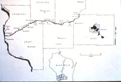
The Wisconsin River is approximately 430 miles long and collects water from 12,280 square miles, about a fifth of the state. Its watershed lies wholly or partially within twenty-five counties in an area roughly 220 by 55 miles. It has nine major tributaries, each draining more than 300 square miles: the Tomahawk (555 m2 ), Rib (489 m2), Eau Claire (456 m2), Big Eau Pleine (370 m2), Yellow (678 m2), Lemonweir (672 m2), Baraboo (60 m2), Pine (326 m2), and Kickapoo (768 m2). Besides these, many smaller rivers and some 388 streams, totaling 1,630 miles in length, feed into it. No small wonder then that it is considered a major line of groundwater discharge in the state.
At Muscoda, a main U. S. Geological Survey gaging station, the rate of water discharged by the river averages 8,746 cubic feet per second (cfs). The highest rate was reached in September of 1938 at 80,8009 cfs and the lowest, 1,240 cfs, was recorded in 1988. This translates into a water level change of almost 11.5 feet. Water velocity averages a little over a mile per hour here but rates between 0.7 and 5.5 miles per hour have been recorded. The average annual rainfall in the watershed is about thirty-one inches. Surprisingly, the hottest recorded temperature in the state, 114į F, was recorded at the Dells in July of 1936, while the coldest recorded temperature on the river, -53į F, only one degree shy of the state record, was recorded in January of 1951 at Lone Rock.
The river drops 1,067 feet between its source at Lac Vieux Desert on the Wisconsin-Michigan border and its confluence with the Mississippi River just south of Prairie du Chien. About 634 feet of the fall occurs in the 150 miles between Rhinelander and Nekoosa. The steepest descent is at Grandfather Falls in Lincoln County, where the river descends about ninety feet in a mile and one-half. Originally, the river dropped about 2.5 feet per mile above Tomahawk, then 4 feet to the base of Wood County, and 1.5 feet thereafter. Present-day water level management has changed this gradient somewhat, making it more step-like.
As seen by the canoeist, the river undergoes numerous metamorphoses in its course from Lac Vieux Desert to the Mississippi. At first they are of natureís doing. But beginning at Watersmeet Lake by Eagle River, where the Otter Rapids dam is sited, manís intervention becomes increasingly apparent. The lake is the first of a dozen major on river flowages formed by dams. On the riverís upper reaches their tailwaters are shallow and often rocky, the current noticeably swifter, and the water level subject to sudden changes. But soon, anticipating the next dam, the riverbed broadens out, and snags, sloughs, and low, boggy islands appear. Near Rainbow Flowage the topography begins to change to an undulating semi-prairie with ridges of glacial origin.
 The riverís central section is dominated by major cities and industrial development. Here, blocking its path, are situated the bulk of the riverís twenty-six dams, necessitating a like number of portages. Below Nekoosa the large expanses of Petenwell and Castle Rock Flowages dominate the scene. Beyond them lies the picturesque gorges of the Dells, a canoeistís delight. Downstream from Prairie du Sac the river appears to be less affected by manís activities, but this is illusionary. Fire has been suppressed, and spring freshets and periodic flooding have been so dampened by the riverís reservoir/dam system that the river cannot cleanse itself; consequently, its bed is narrower than it once was, sandbars are even more prevalent, and biological diversity is decreasing.
Richard Durbin, "The Wisconsin River: An Odyssey Through Space and Time"