Two Days of Hard Paddling
by Mark E. Cupp, Executive Director
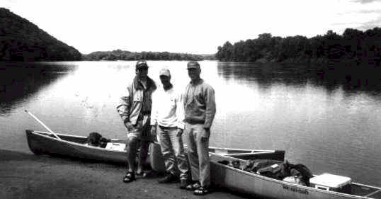
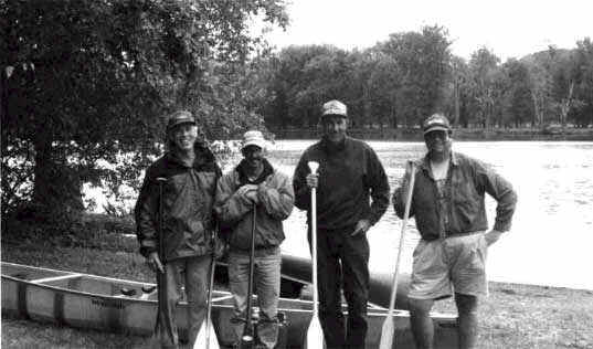
The idea of attempting to canoe the length of the lower Wisconsin River in two days was born from discussions at a Lower Wisconsin State Riverway Board meeting regarding appropriate methods to recognize 150 years of Wisconsin statehood. The journey was intended to reflect the use of the river as a major highway, akin to the Interstate road system of today, for the original inhabitants of the area as well as the Euro-Yankee explorers, missionaries, fur traders and settlers. A delegation comprised of Riverway Board members Brad Glass of Iowa County and Bill Lundberg of Wisconsin Rapids along with Executive Director Mark Cupp and his father, Earl Cupp, decided the attempt would be made on June 4th and 5th.
Riverway Board Chair Jim Staff of Sauk City, who operated one of the largest canoe liveries on the lower Wisconsin River for many years, advised the group that the trip had been done before but infrequently. He said only two canoes he had rented in twenty one years in business had ever completed the trip in two days. Undeterred, the group decided the goal would be the Wyalusing State Park canoe landing which would mean a short excursion on the Mississippi River before entering the backwaters.
At 6:30 a.m. on an unseasonably cool June morning, the group arrived at the new Department of Natural Resources canoe landing at Sauk City. Gear was stowed and balanced and, with a sense of anticipation, if not apprehension, the two canoes embarked on the journey at 7:00 a.m. The fog shrouded river added an ethereal touch to the start of the excursion and enabled the time warp to centuries past to be readily accomplished. The fog also provided navigational challenges and at times was so thick, visibility was limited to 30 feet, the shoreline being only occasionally visible and the river seeming more magical and mysterious than usual. Barely visible through the mist, a mature bald eagle perched on the right bank watched as the canoes slipped by and quickly disappeared into the fog.
Surprisingly, at 8:00, the heavy fog had not lifted and, as a result, Cactus Bluff did not emerge until we were right next to the distinctive rock outcrop. Thirty minutes later, as the fog finally began to lift, we startled five young deer on a willow covered sand bar. Four of the deer quickly raised the white flag and bounded down the sand shore to deeper cover but the larger of the group stopped after a short flight and curiously turned toward the canoes. The creature, standing on a high point, was perfectly silhouetted against the verdant bottomlands forest and, with a few wisps of fog swirling above the river, it made a beautiful and exquisite memory.
With the fog gone and as our strong strokes and vigorous current propelled us down river, there were few signs of modern man to be found. The 1877 journey of Reuben Gold Thwaites, chronicled in the book "Historic Waterways", came to mind and, in particular, the quote,
"…None but a hermit could enjoy those long stretches of waterway, where one may float for a day without seeing man or animal on the forest bound shores, and where the oppression of solitude is felt with such force that it requires but a slight stretch of the imagination to carry one’s self back in thought and feeling to the days when the black robed members of the Company of Jesus first penetrated the gloomy wilderness…"
There were no other canoes or boats on the river as the expedition continued. Two more eagles soared overhead, a killdeer scuttled along the sand bar, red wing blackbirds attacked a crow in the age old battle of survival and the river’s sentinel, the kingfisher, announced our presence to all who would listen.
The journey back in time continued as we approached the first bridge, the railroad bridge at Spring Green. The rusty turnstile mechanism was a reminder that the river was used for commerce before the establishment of the rail although it was only a matter of a few short years before the train replaced the river boat as the most efficient means of transporting goods from one town to another along the river. With the coming of the train, new communities were born, such as Mazomanie and Boscobel, while other river towns faded away, such as Richland City, Port Andrew and Georgetown.
A short distance downstream, below the Hwy. 14 bridge, the shot tower at Tower Hill State Park came into view and thoughts turned to the early days of lead mining in southwestern Wisconsin. The shot tower at Old Helena also is a reminder of the Black Hawk War of 1832 and the subsequent opening of the areas north of the river to white settlement. A few strokes past the shot tower, the grandeur of Taliesin becomes visible, a tribute to the genius and artistry of world renowned architect and Wisconsin native son, Frank Lloyd Wright.
At noon, we pulled into a side channel for a well deserved lunch stop near the power lines between Spring Green and Lone Rock. With 25 miles behind us, a rest stop was welcome and we took the opportunity to stretch our legs and backs.. The cacophony of bird songs surrounding us made it sound more like the Amazon than the Wisconsin but was clear evidence of the abundance of avian life in the valley. One easily wondered if Father Marquette and Louis Jolliet may have chosen this spot for a brief respite from their journey down the Wisconsin River to the Mississippi in the month of June 325 years earlier. The words of Marquette came to mind as he described the river in June of 1673.
"…The Wisconsin River is very broad with a sandy bottom forming many shallows which render navigation difficult. It is full of vine clad islands. On the banks appear fertile lands diversified by woods, prairies and hills. We saw oak, walnut, basswood and another kind of tree armed with long thorns…"
In many places, the lower Wisconsin River of 1998 remains the same as the place viewed by Marquette over three centuries ago. However, in other places, it doesn’t and our reverie was broken by the sounds of traffic rumbling and rattling over the Hwy. 130 bridges at Lone Rock. Soon, thereafter, the bane of the Riverway canoeists, a southwesterly breeze, greeted the expedition. For the next four hours, we paddled into the wind.
At the Avoca Prairie, the blooms of the prairie plants were visible as were the effects of erosion on the sandy river bank. The only other canoes seen on the entire voyage were at this point where a group of ten or twelve canoes of young people were enjoying the day on a sand bar. At 3:00, we passed the remnants of Richland City, once a thriving river town and now a footnote in the river’s history. Shortly after 4:00, we passed Muscoda, the "blooming prairie" noted in Longfellow’s "Hiawatha", and thought of William Hamilton, son of American patriot Alexander Hamilton, who operated a smelter on the banks of the river at what is now known as Lower Town.
We then came upon the Ho-Chunk Farms property where a mound group which somehow escaped the plow of the early settler remains intact. As we stopped for a break, an eagle soared overhead casting a perfect image of the bird effigy mounds predominant in the vicinity. The mysterious significance of the mounds and the people who built the earthworks were readily pondered and, in a natural progression, thoughts streamed of the ancients who carved petroglyphs or painted pictographs on nearby rock shelters. The excitement of the discoveries of the Gottschall rock shelter near Avoca and the perplexing connections to the mounds and the river also came to mind.
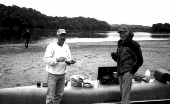
At 5:45, we set up camp near Port Andrew with 50 miles of river behind us. After a hearty meal of spaghetti and a few hours of relaxing by the campfire, we turned in for the night. After an overnight shower, the sky remained overcast and temperatures were cool. Following a breakfast of buckwheat pancakes, breakfast bars and orange juice, at 7:00, we resumed our excursion to the mouth of the river.

The ubiquitous blue heron and several young eagles highlighted the second day’s travels. Damage from the severe storm which passed through the area the previous weekend had been seen throughout the trip but the stretch between Blue River and Boscobel revealed exceptionally heavy damage to trees along the shoreline. The straight line winds must have been exceedingly strong in one spot where a swath of down trees were scattered like match sticks. The huge soft maple trees uprooted and horizontal to the ground made one consider the immense power of the storm and the countless others which have swept through the valley over the eons.
At 11:00, we lunched on the large sand bar at the Big Green landing near Woodman. The river had taken a perceptibly different appearance with fewer sand bars and more wooded islands. For the remainder of the trip, we wove a path between thickly vegetated islands occasionally disappearing from view of our sister canoe only to be reunited at the other end of the island. As we parted company around one of the islands, a young eagle was positioned on a small sand strip at the downstream point of the island. As the eagle watched our canoe, the second canoe slipped through the other channel and came within 25 feet before being detected and indignantly taking flight. The number of eagles seen throughout the trip was indicative of the resurgence in numbers and the success of efforts to save the bald eagle and its habitat.

At 2:20 p.m., we passed under the bridge at Bridgeport and what a sweet sight the bridge was! The beautiful and distinctive Wyalusing bluff was visible for some time, a harbinger of the confluence of the Wisconsin and Mississippi rivers. The current of the Wisconsin seemed to be lost or considerably slowed along this stretch and our weary muscles strained toward our goal. At 3:33, as a turkey vulture gracefully defied gravity and soared aloft without flapping a wing, we entered the Father of Waters. I couldn’t help but think of the words of Marquette when he wrote of his feelings in 1673.
"After 100 miles on this river, we reached the mouth of the Great River. We safely entered the Mississippi on the 17th of June with a joy which I can not express."
Thoughts of Marquette were short lived as the Mississippi brought a heretofore unseen challenge, large wakes created by large motorized craft. We passed under the watchful eye of a perching turkey vulture as we hugged the shoreline feeling the enormity of the Mighty Mississippi compounded by the diminutive size of our noble craft. With the bluffs towering above us and the breadth of the big water seeming huge, we enjoyed a sense of accomplishment knowing our goal was at hand and we had achieved success.
At 4:17 p.m., we landed at the Wyalusing State Park canoe landing. With a ceremonial kiss of the ground and the shaking of hands, we celebrated the culmination of two days of hard paddling. We had gone back through time, from the days before the white man to the early explorers to the settlers to modern times. We had witnessed the good works of man and the undesirable impacts of human deeds. We had seen the wonder of nature and pondered its power. And, we had canoed the Lower Wisconsin State Riverway with the knowledge that the opportunity for future generations to repeat our journey would be available because of the foresight of the Governor, Legislature and citizens of Wisconsin in creating the plan to protect and preserve the magnificent scenic and natural resources of the lower Wisconsin River valley.
